Showing posts with label green belt. Show all posts

Sunday, 13 March 2022

Public Consultation On Leverhulme Estates Proposals to Build on Green Belt Land


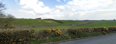
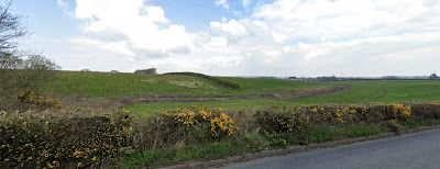
Green belt land in Heswall, one of the sites Leverhulme Estates propose to build housing on
Green belt land in Heswall,
one of the sites Leverhulme Estates propose to build housing on

Leverhulme Estates are running a 'public consultation' on their plans to build on Green Belt. It is online only. 


Please make your views known. Leverhulme Estates need to know the strength of local feeling.


Gills Lane Central
https://gillscentral.consultationonline.co.uk

Gills Lane East

https://gillseast.consultationonline.co.uk

Gills Lane West

https://gillswest.consultationonline.co.uk


Heswall
https://heswall.consultationonline.co.uk

Raby Mere West

https://rabywest.consultationonline.co.uk

Raby Mere East

https://rabyeast.consultationonline.co.uk

Glenwood Drive, Irby

https://glenwooddrive.consultationonline.co.uk

If you support Wirral Wildlife’s concerns about impacts on the climate and wildlife, please submit a comment on at least one of these proposals, to oppose damage to wildlife and loss of green field and Green Belt land.

1. Look up one of the consultation websites as above.

2. Read through - the first 5 boards are identical to each site, the rest are site specific.

3. The last board is a form. Fill in the essential boxes. Ignore questions 1-4 unless you have relevant expertise.

4. Put into the `comments’ box your comments. Suggested points if you support Wirral Wildlife’s concerns about wildlife are:

a) I/We object to release of Green Belt land because of impacts on wildlife.

b) The draft Wirral Local Plan has been published in time for the meeting of full Council on 21st March. This plan will be regeneration-led, with no release of Green Belt land. 

c) Climate change: Currently the fields fix some carbon; housing and associated transport will emit carbon. Housing in the existing urban areas will have lower climate impacts.

d) The consultation does not consider the separate or cumulative effects of these applications on wildlife, such as artificial light at night and wildlife corridors.

Thursday, 6 January 2022

Concerns About Housebuilding Plans on Wirral's Greenbelt


View of greenbelt land from Whitfield Lane in Barnston.

Applications are currently being consulted on for 7 'screening opinions and scoping requests’ submitted by Leverhulme Estates for building houses on Green Belt land in Wirral. NOTE, these are not planning applications (they will come next) but applications to agree with the local authority on what environmental issues and studies are needed to be done before outline planning permission can be applied for. This is purely about environment (in the broad term including heritage) and is not the place to question housing `need’ numbers.


Our concerns are those below, which anyone is welcome to quote in their own comments on the applications.

Links to comment on the applications are below, or you can email 
planningapplications@wirral.gov.uk quoting the reference number.

The closing date to submit your comments is Saturday 29th January 2022.


Concerns relating to all sites

  • The Environmental Impact Assessment (EIA) must consider the cumulative impact of these 7-8 proposals on the environment of Wirral, including on biodiversity. Table 6 omits several planning applications in progress for large amounts of housing, especially in Bromborough/Eastham.
  • The EIA should examine whether there are any environmental `very special circumstances’ for or against building on this Green Belt and greenfield land.
  • The EIA must include impacts on all SBIs neighbouring the site. The current documents omit Harrock Wood (21/02384 Irby) and for the two Raby Hall, Raby Mere (21/02383 and 21/02386) omit Plymyard Dale and Bromborough Golf Course. The EIA must include impacts of supplying services to the land (Raby Mere in particular).
  • The EIA must cover suitable hydrological studies to ensure neighbouring ponds are not drained by falling water tables (Irby and Raby Mere).
  • The EIA must consider buffer zones needed to all the SBIs and Priority Habitats.
  • The EIA must consider ecological networks and the risks of breaking these (Irby).


Items that should be scoped in, not out

Climate change
Greenfield land, even under intensive agriculture, emits little carbon. Houses and their associated transport emit far more.  Ask for a well-respected carbon calculator to be used e.g. as used by the Environment Agency.

Drainage in relation to ponds and water tables (Irby and Raby Mere), and the effects on watercourses (Irby for Arrowe Brook, Raby Mere for River Dibbin, Barnston for Prenton Brook.)

Lighting - These are all relatively dark areas where lights will impact wildlife such as invertebrates, bats.


Further ecological surveys needed

  • Breeding birds, including farmland birds and barn owls (Irby, Raby Mere, Barnston).
  • Great Crested Newts as already detected: Raby Mere, Irby.
  • Water voles as there are reports from Arrowe Brook area and Dibbinsdale (Irby, Raby Mere). Otter can be checked in the survey, though risks are low.


Concerns for specific sites

  • 21/02384 Irby
Ecological networks, drainage to brook and of pond network, surveys needed for breeding birds, great crested newts, water voles. Include impacts on Harrock Wood and buffer zone to Arrowe Park. Wayleave for HVDC Western Link cables.

  • 21/02383 and 21/02386 by Raby Hall, Raby Mere
Surveys for breeding birds, great crested newts, water voles. Drainage impacts on Dibbin and on pond network.

  • 21/92377 Barnston Road Heswall
Breeding birds including farmland.

  • 21/021379, 21/02381, 21/02385 all north of Gills Lane, Barnston
Drainage impacts on Prenton Brook, erosion problems in Barnstondale (where existing erosion whenever the reservoirs are cleaned), more surveys for badgers, breeding birds. Effects on ecological networks.


Links to Screening Opinion and Scoping Request Documents

Please submit your comments by following the links listed below.

  • Land East of Dale View Close, North of Gills lane Pensby – up to 100 houses.

SCR/21/02385

https://planning.wirral.gov.uk/online-applications/applicationDetails.do?activeTab=documents&keyVal=_WIRRA_DCAPR_112773

  • Land East of Thorncroft Drive, North of Gills Lane, Pensby. – up to 15 houses.

SCR/21/02381

https://planning.wirral.gov.uk/online-applications/applicationDetails.do?activeTab=documents&keyVal=_WIRRA_DCAPR_112769

  • Land west of Barnston Road, North Of Gills Lane – up to 160 houses.

SCR/21/02379

https://planning.wirral.gov.uk/online-applications/applicationDetails.do?activeTab=documents&keyVal=_WIRRA_DCAPR_112767

  • Land east of Glenwood Drive, Irby. Up to 310 houses.

SCR/21/02384

https://planning.wirral.gov.uk/online-applications/applicationDetails.do?activeTab=makeComment&keyVal=_WIRRA_DCAPR_112772

  • Land east of Raby Hall, Raby Mere. 85 houses.

SCR/21/02383

https://planning.wirral.gov.uk/online-applications/applicationDetails.do?activeTab=makeComment&keyVal=_WIRRA_DCAPR_112771

  • Land west of Raby Hall, Raby Mere. 40 houses.

SCR/21/02386

https://planning.wirral.gov.uk/online-applications/applicationDetails.do?activeTab=makeComment&keyVal=_WIRRA_DCAPR_112774

  • Land at Milner Road/Barnston Road Heswall. 120 houses

SCR/21/02377

https://planning.wirral.gov.uk/online-applications/applicationDetails.do?activeTab=makeComment&keyVal=_WIRRA_DCAPR_112765


Friday, 5 July 2019

Rotary Club Award For Dr Hilary Ash


The Rotary Club of Bebington have an award named in honour of a previous president, the Harry Partridge Community Award. This is given annually to someone who has made a considerable contribution to the community in the Bebington area. This year the award was given to Dr Hilary Ash, for her work at New Ferry Butterfly Park and for her work on the Green Belt review and other planning issues. The award was presented at the Charter Anniversary Dinner on 1st July.


The photographs show Hilary with retiring President Ron Warne, who just happens to be one of our biological recording volunteers. Hilary is keen to stress that, "All I do is as part of wider teams, on the Butterfly Park and as part of Wirral Wildlife.”

Wednesday, 24 April 2019

Planning With Wildlife In Mind


Woodland at Dibbinsdale SSSI. Photo: Linda Higginbottom

In 2016, Cheshire Wildlife Trust ran a survey asking members what they felt the Trust should focus on. One priority raised was planning, but please don't leave it all to our small staff.

There are three levels of planning development. At national level, there is the National Policy Planning Framework, revised in 2018. The draft, put out for public consultation, did not include any protection for Local Wildlife Sites, the backbone of regional nature conservation. Many organisations and people made representations, and the final version reinstated protection for LWS, along with better protection for ancient woodland and ancient trees. If enough people shout, things can be changed!

The second level is the "Local Plan", so-called even when it applies to an area as big as Cheshire East. These are drawn up by local authorities, with a series of stages and public consultations. In Wirral we are still going through this process, after years of disagreement about how many houses Wirral really needs. High estimates for numbers needed led last autumn to a Green Belt Review over releasing land for building. No-one likes losing Green Belt land, so this has generated much heat and confusion. Green Belt is not a nature conservation designation, but in Wirral, with 46% land already built up, the green areas hold much of our remaining wildlife. Impacts would be felt even by protected sites such as Dibbinsdale SSSI and LWS (eg Prenton Dell, Harrock Wood). Wirral Wildlife has done its own planning comments for 44 years, since Wirral Borough was separated from Cheshire. So we put together a 35-page document, commenting on every parcel of land, about its value (or otherwise) for wildlife conservation, wildlife corridors, flood control, air quality, food production, and its value for people to experience wildlife. We await the next stage, when the planning officers and councillors have managed to digest the 3000+ submissions (they have our sympathy). Because we have a long record of considered, evidenced comments on planning matters, we do know our document will be taken seriously. (Those of you in other areas whose Local Plans are decided or nearly so, do not relax too much - they are subject to 5-yearly review!)

The third level of planning is development control, decisions on applications to build, made using the Local Plan, NPPF, and other "material considerations". Wirral Wildlife rarely needs to object outright, but we often ask for further surveys e.g. bats, and for conditions on the planning permission e.g. to protect trees or wildlife. Our standard badger conditions include "no hole to be left open overnight without a means of escape provided". Some years ago a builder turned up one morning to find a very irate badger in his foundations, which took much time and several skilled people to release.

You can help in 3 main ways:

1) You know your local area best, including where the wildlife is. So keep an eye on your local development control applications, through the press, websites and word of mouth. Write to comment or object, or alert CWT staff to do so.

2) Keep an eye on Local Plan and other consultations. Sometimes CWT will ask for people to write in on such matters; please do so. It may feel like a waste of time, but the ultimate decisions are made by politicians - and they depend on our votes.

3) When development is permitted in your area, look up the conditions on the local authority website, and check to see if they are observed e.g. have the retained trees been protected by fencing? In Wirral we have a good success rate of getting the conditions we want, but Enforcement is our next big challenge.

Hilary Ash,
Hon Conservation Officer

Monday, 22 October 2018

Cheshire Wildlife Trust say Wirral’s wildlife has not been considered in Local Plan


Bluebells in Dibbinsdale SSSI:
housing adjacent would threaten them with loss through trampling.
Photo: Hilary Ash


Cheshire Wildlife Trust have issued a stark warning to Wirral Council on the impact of their proposed development options on Wirral’s wildlife put forward in their local plan.

Rachel Giles, Evidence and Planning Manager at Cheshire Wildlife Trust has put forward her concerns as part of a public consultation on the council’s local plan.

The Trust is concerned that the clear guidance relating to sustainable development has been overlooked by not giving the natural and historic environment equal consideration to economic and social issues and that the plan proposes a significant threat to green belt land.

“We believe that at least 14 of the proposed options would result in significant harm to either SSSIs or Local Wildlife Sites. We are disturbed to see that these have been put forward when the government’s National Planning Framework specifically states that sites of biodiversity should be ‘protected and enhanced’,” said Rachel Giles.

Wirral Wildlife, the local volunteer group of Cheshire Wildlife Trust, has considered every parcel of land proposed. Hilary Ash from the group said, “We are particularly concerned about the possibility of building on large areas of land around Dibbinsdale SSSI, and around Local Wildlife Sites at Irby, Greasby, Prenton, Barnston and Storeton. Other areas under threat include those used by birds from the Dee estuary as roost grounds, and land supporting bats, great crested newts, hares and badgers. The cumulative effects of building on a large proportion of the proposed sites would be very damaging to Wirral’s wildlife, and to the opportunities for local people and visitors to enjoy that wildlife.”

The Trust also believes that the proposed development options have failed to take into account the priority that should be given to supporting a network of habitats for wildlife. “Even the top priority areas of habitat, seem to have been ignored,” said Rachel Giles. “Failure to take the network into account undermines the objectives of ecological network mapping to ensure that wildlife has connected habitat in which to feed, live and breed. The point of network mapping is to inform the planning process so that changes in land use retain and improve wildlife corridors and core sites. This helps reconnect fragmented populations of flora and fauna and over time should help with their recovery. The National Planning Framework states that planning policies must take a ‘strategic approach to maintaining and enhancing networks of habitats’, something that seems to be lost in these proposed plans.” A particular concern is the open land corridor east of the M53.

Cheshire Wildlife Trust have recommended that the ecological network is incorporated into Local Plan policies. “This is essential to inform decisions relating to the various development options and it is unacceptable it hasn’t yet been included,” said Rachel Giles.

Embedding an ‘environmental net gain principle for development, including housing and infrastructure’ is the overarching aim of the government’s 25 Year Plan for the Environment which was released this year. But the Trust believe that this hasn’t been considered in these proposals. “Many of the sites put forward are areas of high wildlife value such as those important for ground nesting birds, which would make net gain very difficult to achieve unless tracts of land were set aside for the purpose of biodiversity offsetting.

The proposals can be viewed on the Wirral Council’s website and comments can be submitted by email to localplan@wirral.gov.uk

by post to The Forward Planning Manager, Wirral Council Economic and Housing Growth, PO Box 290, Brighton Street, Wallasey, CH27 9FQ

or by completing the online form. The public consultation closes on 26th October 2018.

Thursday, 1 September 2016

Hoylake: Green Belt and Greens - Radio 4


Richard Smith, Helen Mark and Hilary Ash


Dr Hilary Ash, Hon. Conservation Officer for Wirral Wildlife, was asked to take part in the Radio 4 programme Open Country. The subject was ‘Hoylake: Green Belt and Greens’.

The details are below and the programme is available on the BBC website http://www.bbc.co.uk/programmes/b07qbl5p

Open Country: Hoylake: Green Belt and Greens
BBC Radio 4 - Thu 01 Sept at 15:02

A new golf resort has been proposed for Hoylake in Wirral. Helen Mark explores how this will affect the local green belt and the birdlife and wildlife that live there.

The programme features Cllr Gerry Ellis, Andrew Needham from the CPRE, John Hutchinson from the Hoylake Golf Resort Committee, botanist Dr Hilary Ash, Richard Smith, David Stacey, and Craig Gilholm from the Royal Liverpool Golf Club.

Some of the 2000 black-tailed godwits Richard Smith was counting (with a few Canada Geese), on the Gilroy scrape at Hoylake. The godwits stop off here on migration south after breeding, so were still in summer  plumage at the time (11 August).